The Search For Bermuda’s Deep Water Caves
The world’s sea level has fluctuated more than 328 feet up and down over the course of the Ice Ages.
We are currently in a period of high sea level, with the potential for sea level to go even higher in response to the Greenhouse Effect and Global Warming.
However, we know relatively little about the opposite extremes of climate and sea level at the height of the last Ice Age.
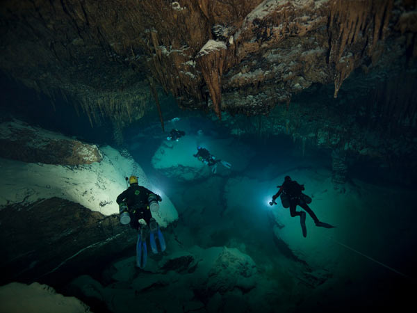
In order to learn more about climate and sea level fluctuations, the US National Oceanic & Atmospheric Administration has been conducting a multi-tiered project to examine wave-generated caves formed during periods of low sea levels around Bermuda.
A small team of the world’s foremost technical and scientific divers visited Bermuda in June to conduct research using state of the art diving equipment.
NOAA Researchers Exploring Bermuda’s Walsingham Cave System This Summer
This project involved multibeam sonar mapping of the vertical cliffs on the Bermuda platform edge, ROV dives to examine particular points on interest mixed gas, closed circuit rebreather dives to make first hand geological and biological collections and observations.
In particular, NOAA has been examining deep cave structures and wave-cut notches that were formed when sea level was at its lowest point.
The NOAA team was led by Dr. Tom Iliffe of Texas A&M University, a former researcher at Bermuda Biological Station [now the Bermuda Institute of Ocean Sciences] and an internationally renowned specialist on the island’s cave systems.
Tongue-In-Cheek Trailer For Upcoming Bermuda Deep Caves Documentary
“The initial two phases of this project were conducted in 2009. First, in collaboration with Dr. Rikk Kvitek of California State University’s Seafloor Mapping Lab, high resolution multibeam sonar was used to produce detailed, geo-referenced maps of the shelf edge of the Bermuda Platform and adjacent Challenger Bank.
“The aim of the mapping was to locate potential deep water caves sites by examining multibeam profiles of the sea bottom to find consistent gaps in the data record which could indicate a void). Numerous potential caves sites including 161 ‘points of interest’ or potential cave locations were located by examining multibeam profiles of the sea bottom.”
Dr. Iliffe said these points of interest were primarily located at northwest, north, east and southwest sides of the main platform and on the southern and eastern margins of Challenger Bank.
They included enclosed karstic sinkholes, numerous ledges, overhangs, possible cave entrances, and near vertical submarine cliff faces between ~80-160 m depths with vertical gullies, sand-floored ledges and landslides.
The heads of several submarine landslides were also discovered around the perimeter of the Bermuda shelf break suggestive of significant mass wasting activity down the flanks of the seamount.
Images courtesy of Jill Heinerth, NOAA Bermuda Deep Water Caves 2011 Exploration Project
Read More About
Category: All, Environment


