
Hurricane Center Monitoring Weather Near Island
The National Hurricane Center is today [August 27] monitoring an area of low pressure centered about 130 miles southwest of Bermuda which is producing winds of around 35 mph.
The Bermuda Weather Service said, “A low pressure center to our southwest is now being monitored by NHC for possible development into a tropical cyclone.
“Warm, moist southeasterly flow on the eastern flank of this low will bring showers and possible thunder today. As this low moves west-northwest weak high pressure will build in from the north bringing mainly fair conditions from tomorrow onward.”
Graphic courtesy of the NHC:
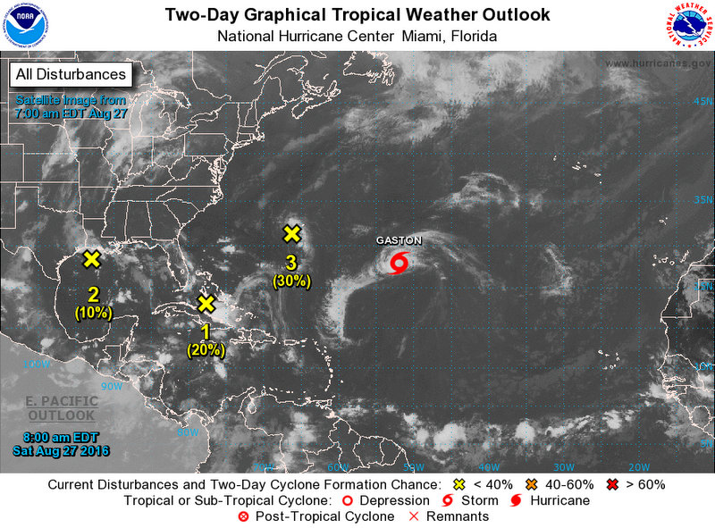
The National Hurricane Center said, “An area of low pressure centered about 130 miles southwest of Bermuda is producing winds of around 35 mph.
“While shower and thunderstorm activity has increased a little near the center during the past few hours, any significant development of this system is likely to be slow to occur due the proximity of dry air.
“This low is expected to move westward and then west-northwestward at about 10 mph toward the coast of the Carolinas during the next few days.”
The Bermuda Weather Service states that Tropical Storm Gaston — the seventh named storm of the 2016 Atlantic hurricane season — is not a threat to Bermuda at this time. The closest point of approach to Bermuda within 72 hrs [3 days] is forecast to be 413 nm to the E, at 3.00am on Monday, August 29.


Hurricane Gaston strengthens in the Atlantic https://www.youtube.com/watch?v=6kk85kW3X-Q
Peolple, update yourself by going to http://www.windyty.com, clic on Hamilton, and see for yourself, dont panic
Nice site. Thanks