
Andrea Weakens To A ‘Remnant Low’
[Updated] Subtropical Storm Andrea has formed in the Atlantic, becoming the first named storm of the 2019 Atlantic Hurricane Season.
The U.S. National Hurricane Center in Miami said Andrea currently has maximum sustained winds near 40 mph [65 km/h] and while slight strengthening is possible overnight, “weakening should begin late Tuesday, and Andrea is expected to dissipate on Wednesday.”
Graphic courtesy of the NHC:
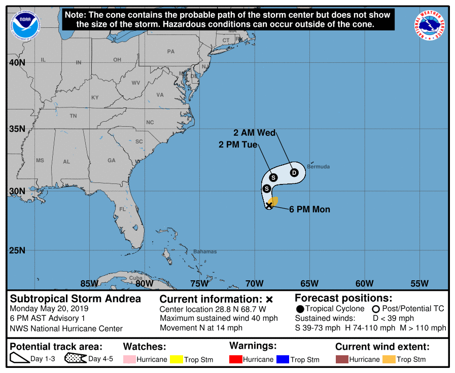
In an advisory issued at 7.30pm Bermuda time this evening [May 20], the NHC said, “At 630 PM AST [2230 UTC], the center of Subtropical Storm Andrea was located near latitude 28.8 North, longitude 68.7 West.
“The storm is moving toward the north near 14 mph [22 km/h]. A decrease in forward speed and a turn to the northeast is expected on Tuesday, followed by an eastward motion by Tuesday night. On the forecast track, the center of Andrea is expected to remain southwest or south of Bermuda during the next day or two.
“Data from an Air Force Reserve Hurricane Hunter plane indicate that the maximum sustained winds are near 40 mph [65 km/h] with higher gusts. Slight strengthening is possible overnight. Weakening should begin late Tuesday, and Andrea is expected to dissipate on Wednesday.
“Winds of 40 mph extend outward up to 70 miles [110 km] northeast of the center. The Air Force Hurricane Hunters measured a minimum central pressure of 1006 mb [29.71 inches].”
Tweet sent by the NHC:
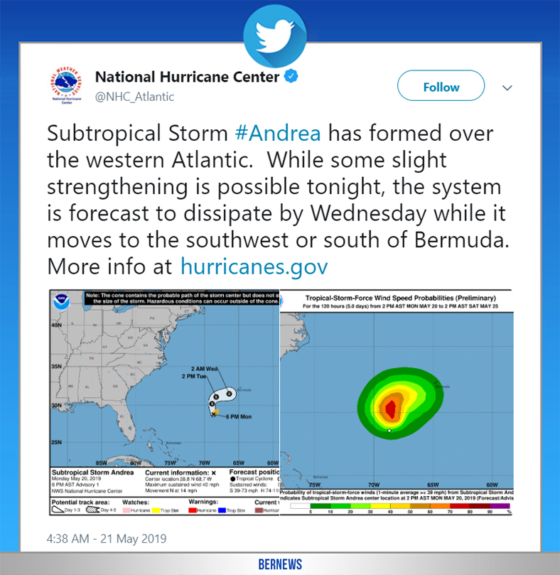
The NHC also tweeted, “Subtropical Storm Andrea has formed over the western Atlantic. While some slight strengthening is possible tonight, the system is forecast to dissipate by Wednesday while it moves to the southwest or south of Bermuda.”
Andrea is ‘early’, having formed in advance of the ‘official’ start of the Atlantic hurricane season, which runs from June 1st through November 30th.
Update May 21, 7.30am: The BWS said that Subtropical Storm Andrea is a “potential threat to Bermuda,” with its closest point of approach to Bermuda within 72 hrs forecast to be 60 nm to the south at 3pm on Wednesday, May 22, with the BWS adding that “this system may move closer to Bermuda after this time period depending upon its track.”
The NHC said, “Little change in strength is forecast today, followed by weakening late tonight. Andrea is expected to dissipate on Wednesday.”
Update May 21, 5.30pm: The NHC said that Andrea has weakened to a ‘remnant low.’

Does Bermuda have a hurricane magnet at its core or something? Why do all the hurricanes seem to divert towards the island, this little tiny dot in such a vast ocean? Oh, and vote Trump 2020.