Hurricane Danielle Strengthens to Category 2
[Updated] The US National Hurricane Centre said that as of 5am this morning [Aug 24] Danielle’s maximum sustained winds had accelerated to 100 miles [160 kilometers] and hour. The hurricane has reached Category 2 status on the Saffir-Simpson 1-to-5 scale, and the Hurricane Centre says that “additional strengthening is forecast, and Danielle could become a major hurricane by Wednesday.”
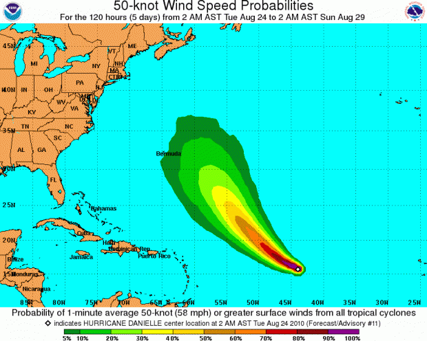
Hurricane Danielle was moving westward at about 20 miles per hour, and is forecast to turn to the northwest by tomorrow passing east of Bermuda at the weekend. It is not projected to “hit us” as such, however forecasters are saying Bermuda residents should closely monitor this storm for potential impacts. The image below, courtesy of the US National Hurricane Centre, shows wind speed probabilities.
Update 2pm: It has now been downgraded to a Category 1 hurricane.
According to AccuWeather.com Tropical Expert Dan Kottlowski, Danielle is a fairly classic Cape Verde storm, which is one that originates near the Cape Verde Islands. Typically, Cape Verde storms have a good chance of developing into major hurricanes due to their long paths over warm waters and minimal interaction with land.
Should Hurricane Danielle strengthen as forecast, it will become the strongest storm so far of the June 1 to November 30th season. Hurricane Alex, the first hurricane of the season, also reached Category 2 status and had 105-mph winds when it hit Mexico.
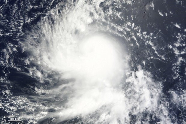
The image below, courtesy of NASA, is natural-color image of Danielle at 9:15 a.m. yesterday:


