BWS: Ernesto “A Potential Threat To Bermuda”
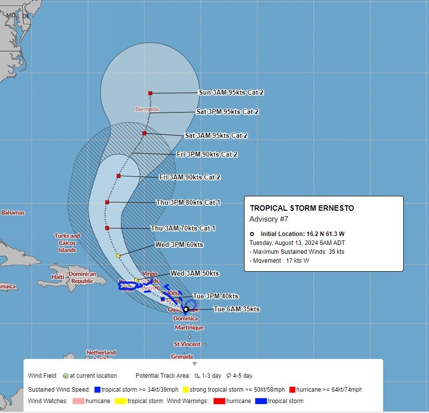
Tropical Storm Ernesto is a “potential threat to Bermuda”, the Bermuda Weather Service said, with its closest point of approach to Bermuda within 72 hours forecast to be 304 nm to the SSW at 6am on Friday [Aug 16] with the BWS noting that “this system may move closer to Bermuda after this time period depending upon its track.”
Graphic courtesy of the BWS:
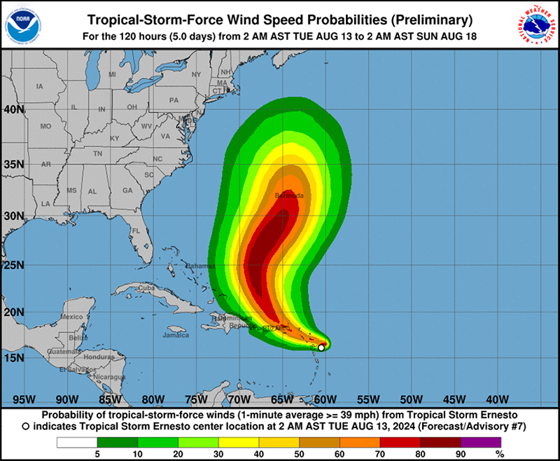
The forecast from the U.S. National Hurricane Center said, “At 500 AM AST [0900 UTC], the center of Tropical Storm Ernesto was located near latitude 16.2 North, longitude 61.3 West. Ernesto is moving toward the west near 20 mph [31 km/h]. A west-northwestward motion with some decrease in forward speed is expected during the next day or so. On the forecast track, Ernesto is expected to move across portions of the Leeward Islands this morning and near or over the U.S. and British Virgin Islands and Puerto Rico by this evening. After passing Puerto Rico and the Virgin Islands, Ernesto is forecast to turn northward over the western Atlantic.
Graphic courtesy of the NHC:
“Maximum sustained winds are near 40 mph [65 km/h] with higher gusts. Gradual strengthening is expected during the next few days, and Ernesto could reach hurricane strength by Thursday over the waters north of the Greater Antilles.
“Tropical-storm-force winds extend outward up to 70 miles [110 km] from the center. St. Barthelemy recently reported a wind gust of 53 mph [85 km/h]. The estimated minimum central pressure based on surface observations in the Leeward Islands is 1007 mb [29.74 inches].”


Looks like some rain coming our way!
Go to TheBermudaTriangle (you know the extension) webpage, Triangle Hurricanes, for the latest weather information from multiple reliable sources – government & private.
Live cams are on the Triangle Cams webpage.
Bahamas – Paradise Island Harbor and Port Nassau cams are currently working
Puerto Rico – Wyndham Grand Rio Mar Live Beach Cam is working
Turks & Caicos – all cams working