Tropical Storm Cindy Forms, Bret Weakens
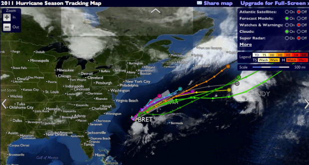
[Updated] The 2011 Atlantic Hurricane Season is underway, with the third named storm of the season forming this evening [July 20].
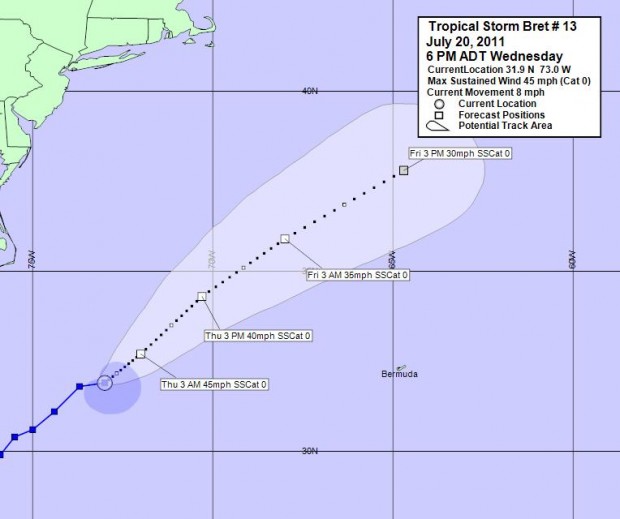
Tropical Storm Cindy is not a threat to Bermuda, however Tropical Storm Bret is expected to pass within 270 nautical miles within us. Bret is weakening, with maximum sustained winds at 45mph, and is expected to weaken further.
Tropical Storm Bret’s closest point of approach to Bermuda within 72 hrs is forecast to be 268 nautical miles to the north west at 1am on Friday July 22.
The Bermuda Weather Service said, “Winds will begin to back southwesterly tonight as Bret begins to move to our west-northwest. The movement and intensity supplied from Bret is being well handled from model guidance in the near-term.”
“Seas as per the latest OPC wave height analysis have held just under 5 feet, slightly less than what model guidance had suggested for today. Seas will continue to range 3-6 feet tonight. Other than the thunderstorm advisory, we do not anticipate any other watches or warnings to be issued tonight.”
Update July 21: This morning the Bermuda Weather Service said Bret’s closest point of approach to Bermuda will be at 10pm tonight, when it is forecast to be 267 nautical miles to the north west. They go on to say that ” Thursday’s weather will be only slightly enhanced by the slow and distant NW passage of a weakening TS Bret.
The forecast for today is, “Sunny periods, one or two showers… Winds south-southwesterly moderate, higher gusts in any showers, increasing moderate afternoon… High near 29°C/85°F.”
“Tropical Storm Bret will slowly pass well to our northwest later Today with moderate winds and a shower or two across Bermuda. A few showers remain possible into the weekend, as high pressure rebuilds across the region, holding tropical moisture in place on southwesterly flow. Please see tropical updates for latest details on Tropical Storm Bret.”


