BWS: Tropical Storm Watch In Effect
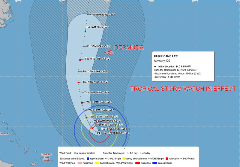
A Tropical Storm Watch in effect, with the Bermuda Weather Service saying Hurricane Lee is a “potential threat to Bermuda”, with its closest point of approach to Bermuda within 72 hours forecast to be 151 nm to the west at 2.00am on Friday [Sept 15], with the BWS noting that “this system may move closer to Bermuda after this time period depending upon its track.”
Graphic courtesy of the BWS:
The latest forecast from the U.S. National Hurricane Center said, “At 1100 AM AST [1500 UTC], the center of Hurricane Lee was located near latitude 24.3 North, longitude 65.9 West. Lee is moving toward the west-northwest near 6 mph [9 km/h]. A slow west-northwest to northwest motion is expected during the next day or two, followed by a turn toward the north by midweek. On the forecast track, Lee is expected to pass near but to the west of Bermuda in a few days.
“NOAA Hurricane Hunter data indicate that the maximum sustained winds remain near 115 mph [185 km/h] with higher gusts. Lee is a category 3 hurricane on the Saffir-Simpson Hurricane Wind Scale. Some slow weakening is forecast during the next 48 hours, but Lee is expected to remain a large and powerful hurricane.
“Hurricane-force winds extend outward up to 90 miles [150 km] from the center and tropical-storm-force winds extend outward up to 205 miles [335 km]. The estimated minimum central pressure is 951 mb [28.09 inches] based on dropsonde data.”
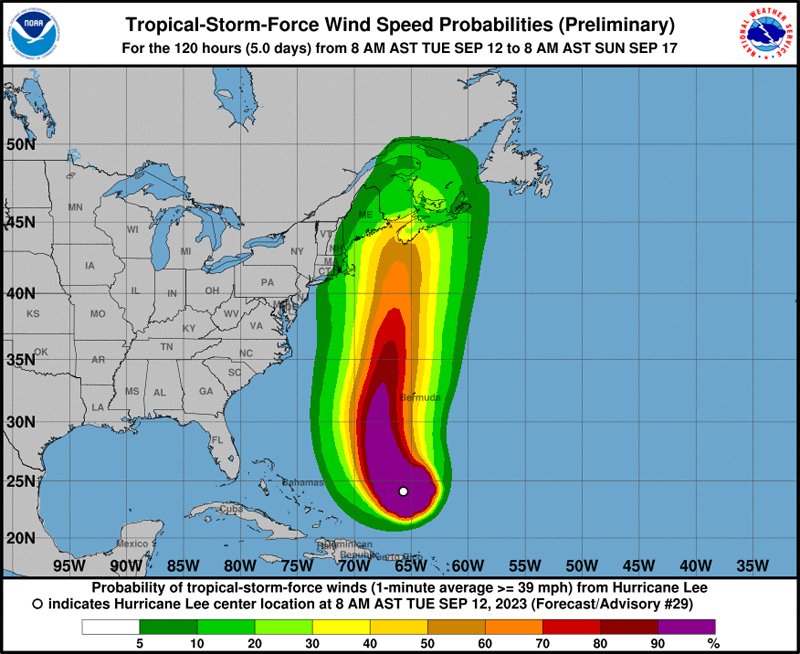
Graphic courtesy of the NHC:


