
Potential Tropical Cyclone Six Forms In Atlantic
Potential Tropical Cyclone Six is “not a threat to Bermuda at this time”, the Bermuda Weather Service said, with its closest point of approach to Bermuda within 72 hrs is forecast to be 1688 nm to the ESE at 12pm on Monday [Sept 3] with the BWS noting that “this system may move closer to Bermuda after this time period depending upon its track.”
Graphic courtesy of the BWS:
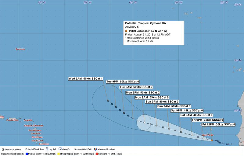
The BWS forecast discussion says, “It should be noted that potential tropical cyclone six is expected to develop into a tropical depression into this afternoon while tracking W’wards/ WNW’wards away from Cape Verde.
“It is then expected to slow slightly but will continue to intensify and likely to become a tropical storm by Saturday morning and a hurricane towards the end of this weekend/ beginning on next week. Initial motion has varied between models and model runs and therefore its long range track remains uncertain.
“At this stage, it is not a threat to Bermuda within the next 3 days but there is potential for it to pass within 400nm towards the end of next week.”
Graphic courtesy of the NHC:
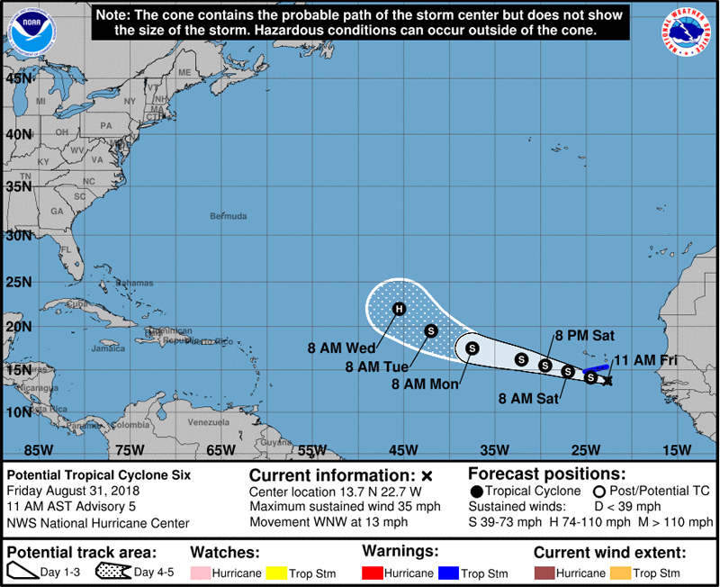
The latest forecast from the U.S. National Hurricane Center said, “At 1100 AM AST [1500 UTC], the disturbance was centered near latitude 13.7 North, longitude 22.7 West.
“The system is moving toward the west-northwest near 13 mph [20 km/h], and this motion with a slight increase in forward speed is expected to continue for the next three to four days. On the forecast track, the disturbance is expected to move near or over the southern Cabo Verde Islands as a tropical storm later today and tonight.
“Maximum sustained winds are near 35 mph [55 km/h] with higher gusts. Strengthening is forecast during the next several days, and the disturbance is expected to become a tropical storm later today or Saturday.”

Read More About
Category: All