BWS: TS Karen Is “Not A Threat At This Time”
Yet another storm has formed in the Atlantic, and Tropical Storm Karen is “not a threat to Bermuda” at this time, the Bermuda Weather Service said.
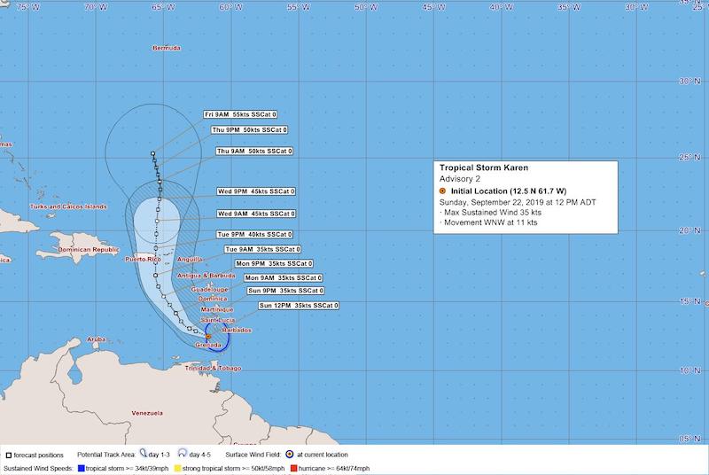
The BWS said, “Closest point of approach to Bermuda within 72 hrs [3 days] is forecast to be 677 nm to the S, 12 pm Wed, Sep 25, 2019. However, this system may move closer to Bermuda after this time period depending upon its track.”
Graphic courtesy of the BWS:
The latest forecast from the U.S. National Hurricane Center said, “At 1100 AM AST [1500 UTC], the center of Tropical Storm Karen was located near latitude 12.5 North, longitude 61.7 West. Karen is moving toward the west-northwest near 13 mph [20 km/h] and this general motion is expected to continue today.
“A turn toward the northwest is forecast to occur on Monday, followed by a turn toward the north on Tuesday. On the forecast track, the center of Karen will move away from the Windward Islands later today, and then across the eastern Caribbean Sea tonight and Monday. On Tuesday, Karen is expected to approach Puerto Rico and the Virgin Islands.
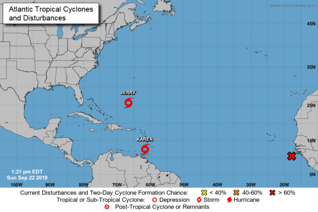
Graphic courtesy of the NHC:
“Maximum sustained winds are near 40 mph [65 km/h] with higher gusts. Little change in strength is forecast during the next 48 hours. Tropical-storm-force winds extend outward up to 105 miles [165 km], primarily in squalls to the east of the center. The estimated minimum central pressure is 1006 mb [29.71 inches].”
BWS Director James Dodgson speaking about TS Karen on today’s Emergency Radio Broadcast:
While Karen is not a threat to Bermuda at this time, Tropical Storm Jerry is, and the Government has urged people to “remain in a hurricane readiness mode” as the island is expected to “experience Tropical Force winds on Tuesday evening.”
You can view our live updates on Hurricane Humberto and TS Jerry here, all our coverage of Hurricane Humberto here, our coverage of TS Jerry here, and all our coverage of the 2019 Hurricane Season here.


