BWS: Monday Morning Hurricane Larry Update
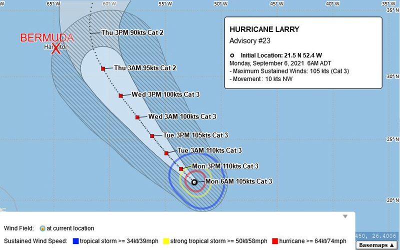
Hurricane Larry is “around 1,000 miles southeast of Bermuda this morning,” the Bermuda Weather Service said, adding that “large swells from the southeast will increase through this week, and dangerous surf will continue to develop on the south shore from today onward.”
The BWS said, “Major Hurricane Larry is around 1,000 miles southeast of Bermuda this morning. Larry is now a Potential Threat, and there is reasonable confidence that it will pass well east of the island on Thursday as a Category 2 storm. However, gusty winds to tropical storm strength are possible as Larry nears on Thursday. Large swells from the southeast will increase through this week, and dangerous surf will continue to develop on the south shore from today onward. Stay safe Bermuda, and keep up to date at www.weather.bm.”
Graphic courtesy of the BWS:
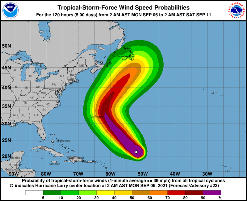
The forecast from the U.S. National Hurricane Center said, “At 500 AM AST [0900 UTC], the center of Hurricane Larry was located near latitude 21.5 North, longitude 52.4 West. Larry is moving toward the northwest near 12 mph [19 km/h], and this general motion with a slight decrease in forward speed is expected over the next couple of days. A slightly faster northwestward motion is forecast by early Thursday.
“Maximum sustained winds are near 120 mph [195 km/h] with higher gusts. Larry is a category 3 hurricane on the Saffir-Simpson Hurricane Wind Scale. Some fluctuations in intensity are possible during the next couple of days. Thereafter, some gradual weakening is forecast.
“Larry is a large hurricane. Hurricane-force winds extend outward up to 70 miles [110 km] from the center, and tropical-storm-force winds extend outward up to 175 miles [280 km]. The estimated minimum central pressure is 956 mb [28.23 inches].”
Graphic courtesy of the NHC:


