
Video: Saildrone USV Tracks Hurricane Ernesto
Saildrone and the National Oceanic and Atmospheric Administration [NOAA] have deployed a fleet of uncrewed surface vehicles [USVs] to track Hurricane Ernesto.
Besides capturing footage of the rough seas amid the storm, the USVs aim to collect data on storm formation and intensification as part of an ongoing mission to better understand these powerful weather systems.
The Saildrone website said, “Saildrone Explorer USVs are 23 feet long and carry a payload of sensors to measure air, surface, and water temperature and humidity, barometric pressure, wind speed and direction, salinity, and wave height and period. To withstand major hurricane conditions—winds over 110 mph and waves that exceed 50 feet—they have a shorter and stronger “hurricane wing,” similar to a reefed sail on a sailboat.
“Saildrone USVs sail autonomously along prescribed routes, which are defined by Saildrone Pilots according to weather conditions and to meet mission objectives. Saildrone’s science partners in the mission at NOAA’s Atlantic Oceanographic & Meteorological Laboratory [AOML] and Pacific Marine Environmental Laboratory [PMEL] will work closely with Saildrone Mission Control to guide the saildrones into oncoming hurricanes.”
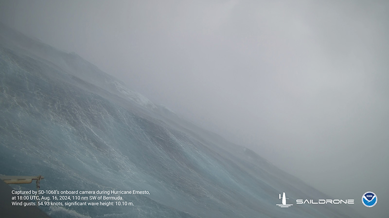
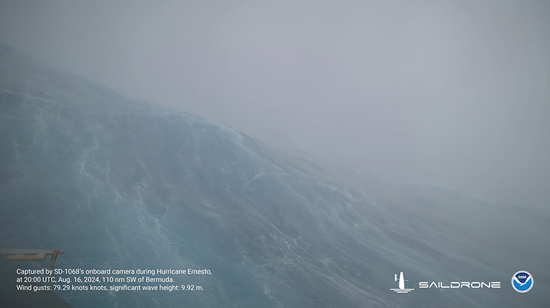
Images taken by Saildrone about 110 nautical miles off Bermuda
Click here for all of our coverage of Hurricane Ernesto, and click here for our ongoing live updates on the storm.


Read More About
Category: All, News, technology, Videos