Gaston Strengthens, “Not A Threat At This Time”
[Updated] Gaston has this morning [August 28] been upgraded to hurricane status again with the Bermuda Weather Service saying “Hurricane Gaston is not a threat to Bermuda at this time.
“The closest point of approach to Bermuda within 72 hrs [3 days] is forecast to be 491 nm to the E, 3.00am on Monday, August 29, 2016.”
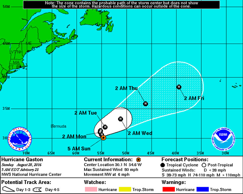
The National Hurricane Center said that Gaston is about 620 miles east of Bermuda with maximum sustained winds of 90 mph and continues to strengthen.
Graphic courtesy of the NHC:
The NHC said, At 500 AM AST [0900 UTC], the center of Hurricane Gaston was located near latitude 30.1 North, longitude 54.6 West. Gaston is moving toward the northwest near 6 mph [9 km/h]. A slow northwestward motion is expected through tonight, followed by a slow northward or northeastward motion Monday and Monday night.
“Maximum sustained winds have increased to near 90 mph with higher gusts. Some additional strengthening is forecast during the next 48 hours.
“Hurricane-force winds extend outward up to 15 miles [30 km] from the center and tropical-storm-force winds extend outward up to 140 miles.”
An update from the NHC on the area of low pressure located west of Bermuda said, “Shower and thunderstorm activity has increased during the past few hours in association with an area of low pressure located about 250 miles west of Bermuda.
“While environmental conditions are only marginally conducive, some additional development of this system is possible during the next day or so while it moves west-northwestward at about 10 mph. As the low approaches the coast of North Carolina by mid-week, conditions are expected to become unfavorable for further development.”
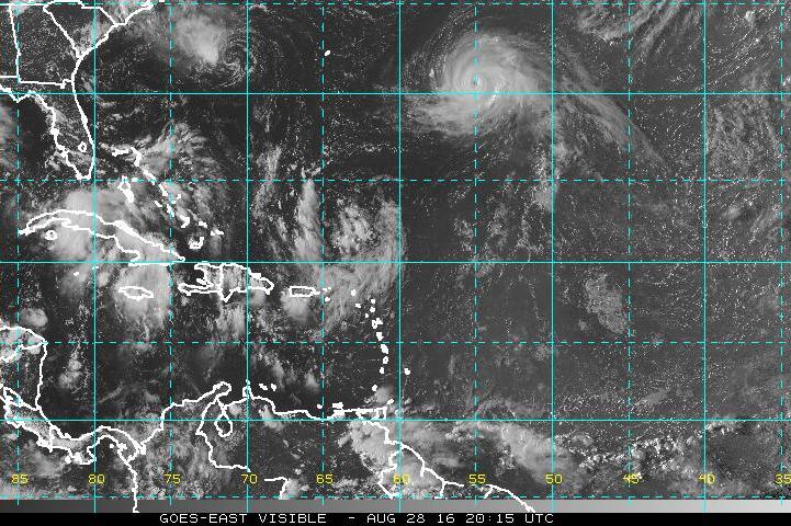
Update 6.03pm: The National Hurricane Center has announced that Gaston which is about 580 miles east of Bermuda has strengthened into the first major hurricane of the 2016 season.
The NHC said, “At 500 PM AST [2100 UTC], the eye of Hurricane Gaston was located near latitude 30.8 North, longitude 55.1 West. Gaston is moving toward the northwest near 5 mph [7 km/h], and a turn toward the north is expected on Monday, followed by a turn toward the northeast and then east-northeast with some increase in forward speed on Tuesday.
“Satellite images indicate that the maximum sustained winds have increased to near 115 mph [185 km/h] with higher gusts. Gaston is a category 3 hurricane on the Saffir-Simpson Hurricane Wind Scale. Little change in strength is forecast during the next 48 hours.
“Hurricane-force winds extend outward up to 25 miles [35 km] from the center and tropical-storm-force winds extend outward up to 140 miles [220 km].”


