Tropical Storm Watch Is Issued For Bermuda
[Updated 2: 14 am, Nov. 8.] The US National Hurricane Centre [NHC] says Sub-tropical Storm Sean formed early this morning [Nov. 8] midway between Bermuda and The Bahamas.
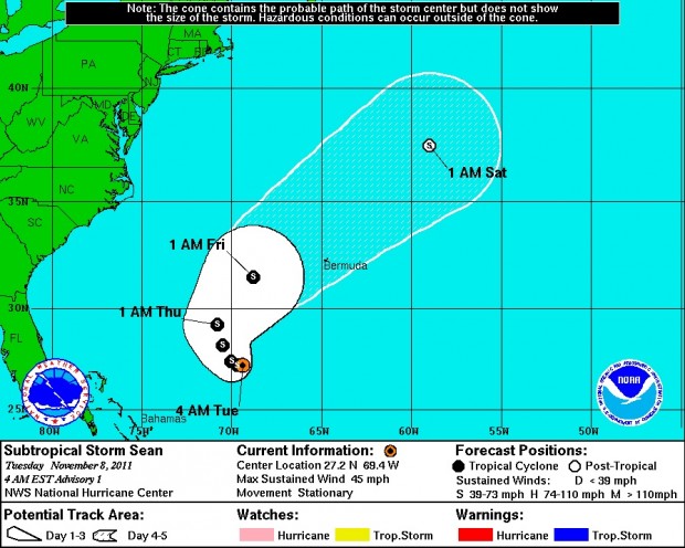
As of the 5:00 a.m. Bermuda time, Sean was located about 445 miles southwest of Bermuda with maximum sustained winds of 45 miles per hour.
Sean is nearly stationary. Forecasters believe the storm will begin a slow westward or northwestward motion by Tuesday night or Wednesday.
The Bermuda Weather Service placed the island on a tropical storm watch at 11:30 am this morning: “Subtropical storm Sean maintains unsettled weather through Friday. Subtropical storm Sean, 365 nm to our southwest, slowly moves northwest, then northeast over the next few days. Its closest point of approach is to our near northwest on Friday morning and Sean is now a threat to Bermuda.”
“Conditions will remain windy and showery, with tropical storm force winds likely later on Thursday through Friday morning.” .
Five Day Tracking Map Of Sub-Tropical Storm Sean Issued This Morning [Nov.8]
The sub-tropical cyclone is forecast to make a northeast turn on Thursday and pass north of Bermuda on Friday. It is not expected to strengthen into a hurricane.
Winds of up to 40 mph extend out up to 380 miles from Sean’s center of circulation, primary west through northeast of its centre.
In its 5: 30 am advisory, the BWS said as Sean begins to move west then north strong winds, occasional showers and isolated thunderstorms will continue to affect the island.
“By Friday, Sean will have moved well to our north and will drag a cold front over the region,” said a BWS forecaster. “Settled conditions with easing winds look to finally arrive by the weekend.
Today’s forecast is for occasional rain or showers, with a risk of thunderstorms Easterly winds will continue to be strong, with higher gusts possible in and around showers.
Last night [Nov.7] the NHC doubled the odds of the low pressure system becoming a subtropical cyclone.
Earlier yesterday NHC forecasters said there was only a one-in-three chance of the storm developing into a cyclone – but by the afternoon forecasters said there was now a “high chance” of this happening.
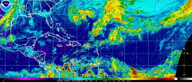
National Hurricane Centre Imaging Of The Low-Pressure Front Taken Yesterday [Nov.7]
“The associated showers and thunderstorms continue to show signs of organisation, and the low could acquire subtropical characteristics tonight or on Tuesday,” said the NHC. “This system has a high chance, 60 percent, of becoming a subtropical cyclone during the next 48 hours as it moves slowly westward today and northwestward on Tuesday.”
Sharing some characteristics with hurricanes, sub-tropical cyclones can have maximum winds extending farther from the centre than in a purely tropical cyclone and have no weather fronts linking directly to the centre of circulation.
The maximum recorded wind speed for a subtropical storm is 74 miles per hour — also the minimum for a hurricane.
Gale-force winds from the low-pressure system have caused chaos in Bermuda and the surrounding waters in recent days.
There have been intermittent power blackouts throughout the island, ferry services have been disrupted and the start of the island’s World Rugby Classic had to be postponed on Sunday [Nov.6] after gale-force winds hammered the National Sports Centre venue,
Yesterdayy the Bermuda Maritime Operations Centre reported yachtsman en route to Bermuda had to be rescued because of rough seas and the arrival of at least one cruise ship has been pushed back a day because of the bad weather.
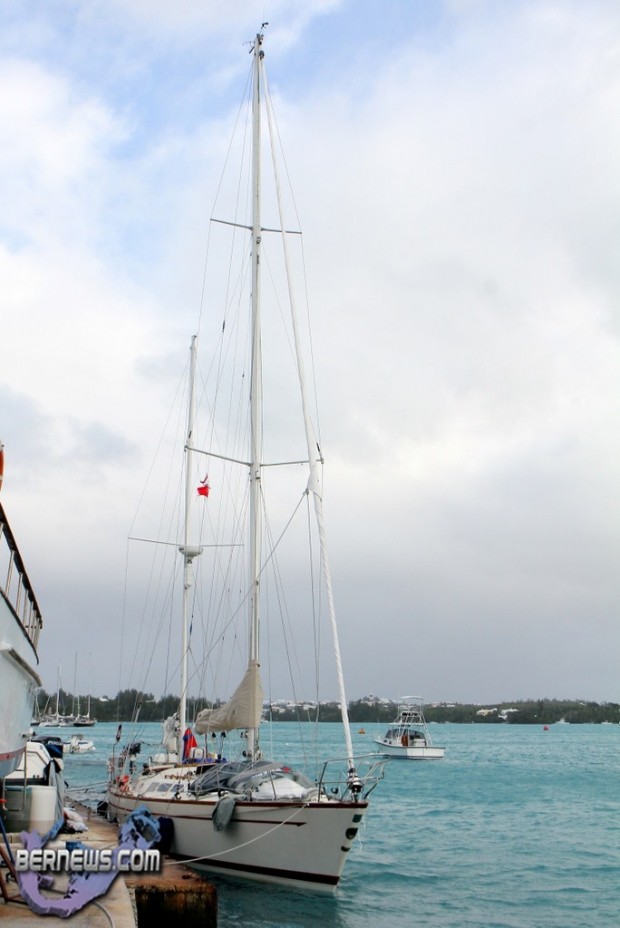
The Yacht “Riot” Was Brought Into Bermuda Today By The Pilot Boat “St. George” And The Tug “Powerful”

A 4.30 pm update by the Bermuda Weather Service issued yesterday afternoon reported the low-pressure system would likely to begin veering away from the island in the coming days.
“A deep low to our southwest is being monitored for further development, but will move away slightly before curving northwest, then north after midweek,” said the BWS. “Strong winds will continue across Bermuda, with gusts to gale force around occasional showers tonight and Tuesday, with a chance for thunder from late tonight.
“Wet periods continue Wednesday with a period of easing winds.”


Good work Marine and Ports,and Bermuda Radio!
Still no report into the damage at the Heritage Wharf thruster wall. Its now 9 weeks since the Public Works minister promised the people of Bermuda he would make the report public. It was during the Sept 7th Everest De Costa radio program that he said it would be released the following week. So much for integrity. Sounds like lies to me.
Sean came out of nowhere. What happens if it increases in strength and comes at Bermuda? If further damage occurs who is responsible? When is the thruster wall to be fixed? How much will it cost us the Taxpayer? Who was responsible for the damage? Is there any compensation?
I think government needs to come clean.