BWS: Tuesday Morning Hurricane Larry Update
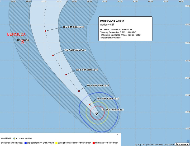
Hurricane Larry is a “potential threat to Bermuda”, the Bermuda Weather Service said, with its closest point of approach to Bermuda within 72 hours forecast to be 162 nm to the ENE at 2.00pm on Thursday [Sept 9], with the BWS noting that “this system may move closer to Bermuda after this time period depending upon its track.”
Their forecast for today states, “An old frontal boundary moves back into the area today, bringing a few showers and a possible rumble of thunder. This then clears on Wednesday in advance of approaching Hurricane Larry, which brings deteriorating conditions Wednesday night into Thursday with strengthening winds and further wet weather. Hazardous swells gradually develop, especially along the South Shore, with dangerous surf and rip currents.”
Graphic courtesy of the BWS:
The latest forecast from the U.S. National Hurricane Center said, “At 500 AM AST [0900 UTC], the center of Hurricane Larry was located near latitude 23.8 North, longitude 55.1 West. Larry is moving toward the northwest near 10 mph [17 km/h], and this general motion is expected to continue through Wednesday. A turn toward the north-northwest and north with an increase in forward speed is forecast on Thursday.
“Maximum sustained winds are near 120 mph [195 km/h] with higher gusts. Larry is a category 3 hurricane on the Saffir-Simpson Hurricane Wind Scale. Some gradual weakening is forecast during the next several days.
“Larry is a large hurricane. Hurricane-force winds extend outward up to 70 miles [110 km] from the center, and tropical-storm-force winds extend outward up to 185 miles [295 km]. The estimated minimum central pressure is 958 mb [28.29 inches].”
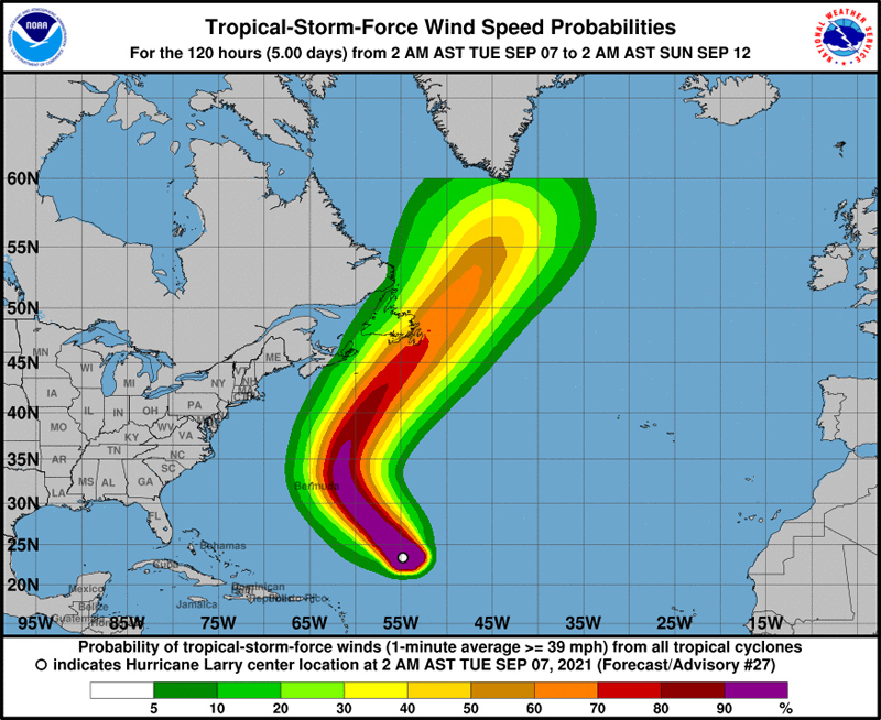
Graphic courtesy of the NHC:


Wonder if retailers will force sales associated to come to work that day or maybe government will step in and sort it all out.