
Bermuda Image From Space 14 Years Ago
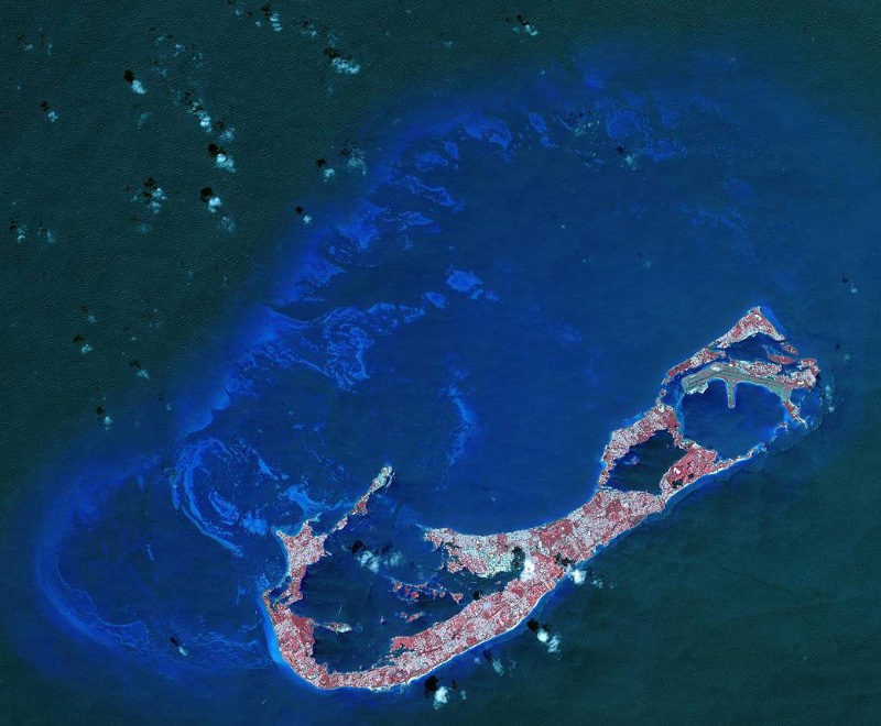
14 years ago today [April 19], Bermuda was captured from orbit by the Advanced Spaceborne Thermal Emission and Reflection Radiometer [ASTER], an instrument that “produces images using infrared, red, and green wavelengths of light.”
The NASA website said, “Bermuda is a British Overseas Territory in the western Atlantic off the east coast of North America. The uninhabited islands were first discovered in 1503 by the Spanish explorer Juan de Bermudez. In 1609 the English Virginia Colony settled Bermuda, and it has remained a British colony for over 400 years. Bermuda’s economy is dominated by offshore insurance, and tourism, resulting in a very high GDP per capita.
“The image was acquired April 19, 2009, covers an area of 29.4 by 40.7 kilometers, and is located at 32.3 degrees north, 64.8 degrees west.
“With its 14 spectral bands from the visible to the thermal infrared wavelength region and its high spatial resolution of 15 to 90 meters [about 50 to 300 feet], ASTER images Earth to map and monitor the changing surface of our planet.
“ASTER is one of five Earth-observing instruments launched Dec. 18, 1999, on Terra. The instrument was built by Japan’s Ministry of Economy, Trade and Industry. A joint U.S./Japan science team is responsible for validation and calibration of the instrument and data products.
“The broad spectral coverage and high spectral resolution of ASTER provides scientists in numerous disciplines with critical information for surface mapping and monitoring of dynamic conditions and temporal change.”


Read More About
Category: All, History, technology
Wow , look at all that open space just waiting to be developed ~/s