Katia Becomes Second Hurricane Of 2011
[Updated] Tropical Storm Katia is “almost a hurricane” said the latest update from the U.S. National Hurricane Center in Miami.
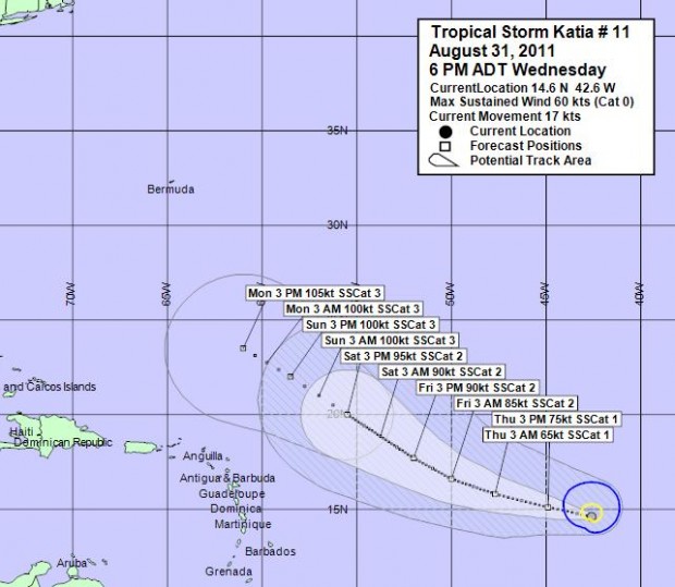
“Maximum sustained winds have increased to near 70 mph with higher gusts. Additional strengthening is forecast during the next 48 hours and Katia is likely to become a hurricane tonight. Tropical storm force winds extend outward up to 125 miles from the centre,” said the NHC.
As of 6:00pm today [Aug. 31] the Bermuda Weather Service said the center of Tropical Storm Katia was located 1612 nautical miles east south-east of Bermuda. The storm is moving toward the west-northwest near 20 mph and a gradual slowing of forward speed is expected over the next 48 hours.
The BWS said Tropical Storm Katia’s “closest point of approach to Bermuda within 72 hrs [3 days] is forecast to be 867 nautical miles to the south-east, 6:00pm Sat, Sep 3, 2011.”
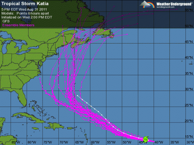
In a video report, Accuweather said: “It could have a track which could take it very close to Bermuda some time around the middle of next week so we have to keep a careful eye on that.” The graphic below, courtesy of Weather Underground, shows their model of Katia’s possible path:
Update 12:03am: At their midnight [Bermuda time] update, the U.S. National Hurricane Center upgraded Katia to a Category 1 hurricane. Katia – the second hurricane of the 2011 Atlantic Season – is carrying maximum sustained winds of 75mph.


its our turn..ready?
Still early, but this one does not look good for Bermuda especially if it passes close to the west giving us the more violent further extending winds of the eastern quadrants.
Why are you showing the ensembled model? All that shows is were past hurricanes have gone and have nothing to do with what track this hurricane will take. Why not show the actual computer models? Oh yeah I know why, because they show that that Katia will be well west of us before it starts to curve, but then that isn’t scarry, which makes for good news.
Buckle your seatbelts – its gonna be a bumpy ride!!
Why do I have to look at the US weather channel to get a more accurate report then what Bermuda weather service offers us?
http://www.stormpulse.com