Video: Animated 2010 Hurricane Season
 A new animation programme based on US National Oceanic & Atmospheric Administration tracking data provides a dramatic visualisation of the just-ended 2010 hurricane season, showing the near-misses Bermuda experienced this year — as well as the island’s close brush with Igor.
The Atlantic hurricane season runs between June and November. This year’s hurricane season was the third most active on record for the Atlantic with 19 named storms. However, few of those storms made landfall – and when a steadily weakening Igor swept past Bermuda in September, the hurricane caused far less damage than was originally anticipated.
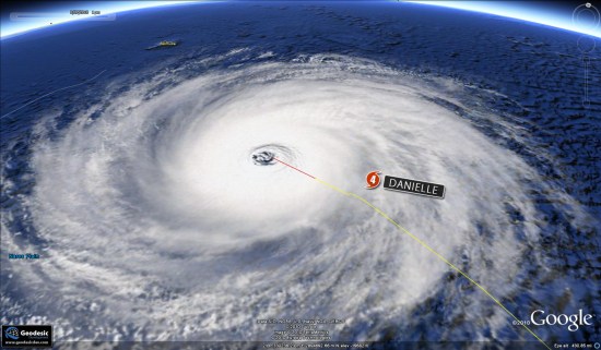
Geodisic Developments, a US outfit which uses Google Earth imagery and web-based applications for geospatial data, released its new hurricane season application today. ”The overlays used are a compilation of satellite imagery of classic storms, creating a realistic look and feel,” said the company. “Size and scale are based on the NOAA storm data for the positions and intensity of each storm.”
The image above is taken from the tracking application and shows Hurricane Danielle drawing close to Bermuda in August. The second hurricane of the 2010 season, Danielle brought large swells and battering waves to Bermuda before passing east of the island on August 29.
A sped-up version of the file appears below.

