Videos & Charts: Hurricane Igor
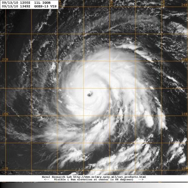
The video and images below show the projected path as well as satellite views of the powerful Category 4 Hurricane Igor. The US National Hurricane Center said this morning that Igor had weakened some, with maximum sustained winds dropping from 150mph to 135mph, and that more fluctuations are expected.
As of 6am today [Sept 14] the Bermuda Weather Service says that “Hurricane Igor is not a threat to Bermuda at this time,” and that it is presently 1118 nautical miles south-east of Bermuda. Forecast charts show the hurricane moving in a westerly direction closer to our region, and the Weather Channel has said that Bermuda should monitor the progress of Hurricane Igor as it could pass close by this weekend.
Cameras on the International Space Station captured views of Hurricane Igor heading westward over the Atlantic yesterday morning. Igor was at Category 4 strength with maximum sustained winds near 150 mph. Video courtesy of NASA.
Quick clip of hurricane satellite imagery from this morning. The eye of the storm is visible in the video below, with the eye being 30 miles wide – larger than Bermuda.
Quick raw video from the GOES 15 satellite of Hurricane Igor.
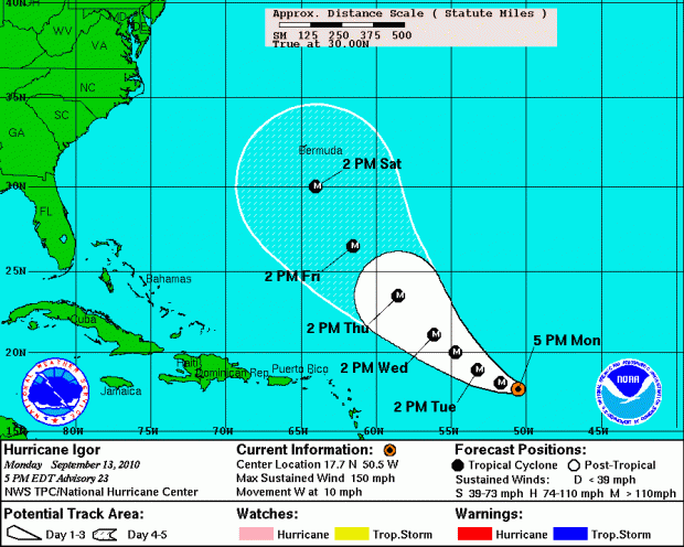
Tracking chart courtesy National Hurricane Center:
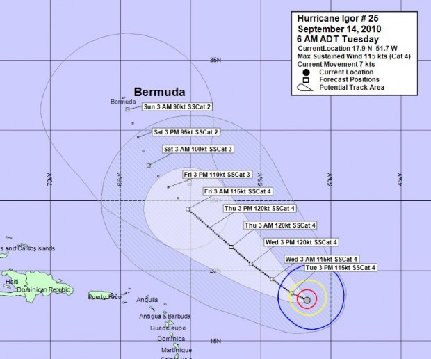
Tracking chart courtesy Bermuda Weather Service:
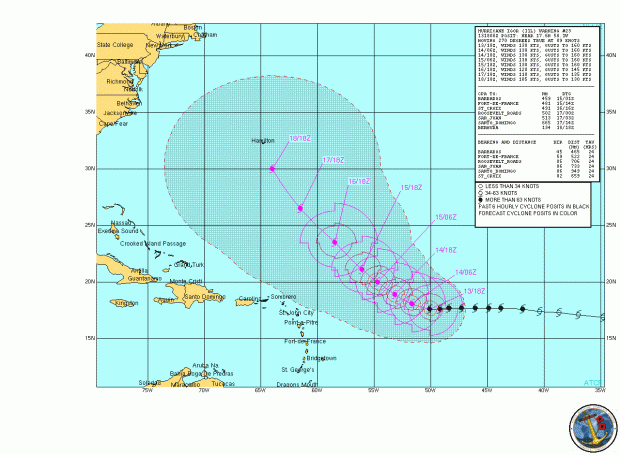
Tracking chart courtesy Naval Meteorology and Oceanography Center:
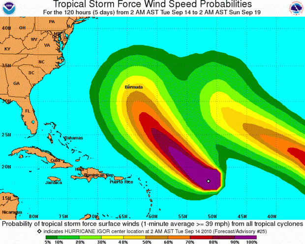
Wind speed probability chart courtesy National Hurricane Center:
Satellite image courtesy Naval Research Lab:
Read More About
Comments (3)
Trackback URL | Comments RSS Feed
Articles that link to this one:
- “Harder To Ignore Potential Fabian Type Impacts” | Bernews.com | September 14, 2010


“Hurricane Igor is not a threat to Bermuda at this time.” That’s some pretty piss poor weather predicting. Now Guishard is saying ” “Make no mistake, even if the center of this system misses the island, we will experience significant impacts.””
And when you said it was not a threat, where was the storm going to go to that would make it not a threat? Was it going to just veer off 500 miles despite the fact that every computer model at the time had a category 4 storm within 100 miles of the island. This weather service is a joke. They use continent-based warnings, so that they sound the alarm right as 15 foot waves are hitting the causeway. What kind of warning is that? We live on an isolated island. If this guy would be hitting the warning button on the 13th, then maybe stores would have enough time to order in surplus of supplies? Maybe we could actually afford a flight off the island? Seriously, a storm this size is predicted to hit us dead on pretty rarely (all time considered), and it seems that given our particular situation as an isolated island without the means to support 65k residents without external life lines, our weather service should be issuing panic mode a lot sooner than after the last plane has left the island and shit is under water.
Of course, that’s what happened in 2003 too. Weather Service kept marginalizing it, and saying it wasn’t a sure thing, until the fucking causeway was flooded. Worthless. Absolutely worthless. Seems the only person with any foresight was the premier, who canceled his trips on Wednesday.
Of course this is what you should expect from a weather forecaster who says (and I quote) “Please be assured that all appropriate action is being taken by us to accurately forecast the local conditions, convey uncertainty and advise decision-makers accordingly, despite the fact that Igor is currently over 1000 nm away, and not quite a Potential Threat yet.” ” -DR. Mark Guishard, Ph.D. on Sept 14th (72 hours ago)
“as I have already said in previous media statements, this is not the time to be complacent. Be safe and god bless.” Guishard fails to note “in the last 24 hours”, 72 hours ago he was calling it not a potential threat. You’d think that satellite photo would give him a little more notice than 36 hours that 80 hours of torrential rain and wrath-of-God winds was coming.