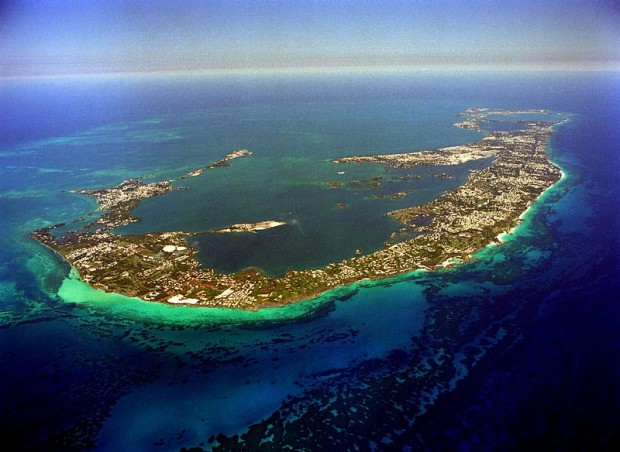
New Bermuda Aerial Mapping Project
An aerial survey of Bermuda will shortly be underway with the aim of providing current geographical data of the island.
The Department of Land Surveys and Registration, under the Ministry of Environment, Planning and Infrastructure Strategy, commissioned the survey, which will be conducted in two parts.
The first requires a specialist survey aircraft to take high resolution aerial photography of the island, using a camera mounted in the fuselage.
The airplane will fly up and down the island at a relatively low altitude, taking a series of photographs of the ground. This stage will begin early next month and hence the Ministry would like to advise the public in advance that there is no need to be alarmed by the low-flying aircraft.
In the second stage of the project, the survey company will extract information from the photographs, and create a digital map of Bermuda.
Through this method a technician can view the ground in three dimensions, and can trace the outlines and buildings to great accuracy.
The aircraft has an on-board GPS navigation system, which fixes its position every second to an accuracy of about 5cm. However, when the airplane is flying at close to 100mph, even a one second interval leaves big gaps between photographs, and additional work is required to exactly locate the camera’s position.
To do this, Survey Section needs to mark the ground with a number of large white targets which are surveyed to great accuracy, and are used to orientate and scale the photographs and “connect” them to the ground.
Staff from the Land Surveys Department began painting such targets on Monday.
.
Senior Land Surveyor at the Ministry of Environment, Planning and Infrastructure Strategy Peter Hopkin BA, FRICS, MSc (GIS), said: “While many of these targets have been placed on Government or public land, inevitably some needed to be placed on private land, and the Ministry is very
grateful to those land-owners who have graciously agreed to allow us to paint targets on their property.
“This aerial survey is the culmination of seven years’ work to upgrade Bermuda’s national reference system for modern use. There is a high, and rapidly increasing, demand for digital data for use with Geographic Information Systems [GIS] both within Government and from the private sector.”
The mapping project will cost about $260,000. The data will be used extensively throughout Government, but copies of the photographs and mapping will be available for purchase by the public.
The Minister of Environment, Planning and Infrastructure Strategy Marc Bean said: “The Bermuda Mapping Update Project is something that will be of great benefit to our island and is long overdue. Aerial photography and mapping were last updated in 2003 and since then over 1200 addresses have been created and are not mapped.
“Significant infrastructure developments are missing from the maps such as the National Stadium, Berkeley School and large housing developments such as Whale Watch, Loughlands and Harbour Side Village. Furthermore, many buildings and infrastructure no longer exist but are still shown on the existing mapping, for example the Sonesta Beach Resort and the Club Med Hotel.
“The omission of key detail reduces the quality and value of mapping. Up-todate quality mapping is fundamental to Bermuda’s modern digital economy because the majority of government and private projects require spatial information to operate.”
Read More About
Category: All, Environment
Comments (9)
Trackback URL | Comments RSS Feed
Articles that link to this one:
- Low Flying Airplane Over Bermuda Today | Bernews.com | August 14, 2012


was this in the budget?
Is this new Liability really worth doing or is it so Mr Weeks can take his daughter on a plane ride?
What foolishness is this, haven’t they heard of Google Earth? ITS FREE!!! plus Google Earth Has recently updated their shots of Bermuda to include the New Berkeley, John Swans new Building the new Court Bldg etc.
Google Earth may be fine for browsing and your cellphone, but it has poor resolution and reliability for mapping purposes at a scale relevant to tracking Bermuda’s land and property assets. The implementation of the Land Title Registry, for instance, is a key factor in progressing this aerial survey this year. An aerial survey and mapping update hasn’t been done since 2003, with only limited lower resolution satellite imagery in between. It is high time for this project to be done.
Thats realy good!! GPS the whole island :} a nice update.
So tru.
This is a great idea.
Take a chill pill fer crying out loud!
This is supposed to be done on a regular basis and Google is for non commercial use…did you not get the hint! Its being done by the Survey Section? Planning, BPS, BFRS, King Edward and Environment use the highly accurate data and maps to do their jobs and protect us all.
Liars & mixitup, you are just exposing your own personal bias to the world, what does Minister Weeks’ daughter have to do with anything and this isn’t a new liability it was to have been updated years ago…ya know to compare what was then to what is now…insignificant stuff to you I’m sure like erosion and water levels. Yeah google earth is free but isn’t updated regularly or as accurate as these surveys are and isn’t owned by us (BERMUDA) to do with what we wish and again read the disclaimer that says NOT FOR COMMERCIAL USE.
You both are in the words of the great Carlos Mencia…..Dee dee dee
Will taxi drivers be assisting the mapping? They know where everywhere is & a few of them even have GPS experience. All of them are world travelers & would never turn down a plane ride.