
First Named Storm Of 2014 Hurricane Season
Tropical Storm Arthur — the first named storm of the 2014 Atlantic hurricane season — is expected to become a hurricane by Thursday, the U.S. National Hurricane Center said today [July 1].
Located some 85 miles off Cape Canaveral, Florida, the system has maximum sustained winds of 50 mph and is moving at 2mph to the northwest, the NHC said.
The Bermuda Weather Service said Arthur is not a threat to Bermuda at this time, and its closest point of approach to Bermuda within 72 hrs [3 days] is forecast to be 487 nautical miles to the north-west at 6.00pm on Friday, July 4th.
Chart courtesy of the BWS:
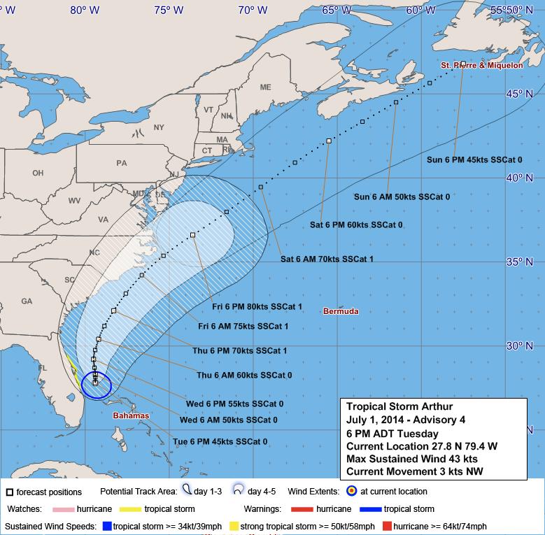
In the forecast discussion, BWS’s Jeremy Entwistle said, ” Tropical Storm Arthur [likely Hurricane Arthur] to our W is well-forecast in guidance to move NE’ward across the North Carolina outer banks Friday and accelerate toward Nova Scotia through Saturday, while becoming extra-tropical.
“Based on this forecast, the only expected effect on Bermuda will be an increase in convergent shower activity Saturday and developing frontal activity Saturday and into Sunday. A Thunderstorm Advisory and Small Craft Warning may be required for late Saturday.”
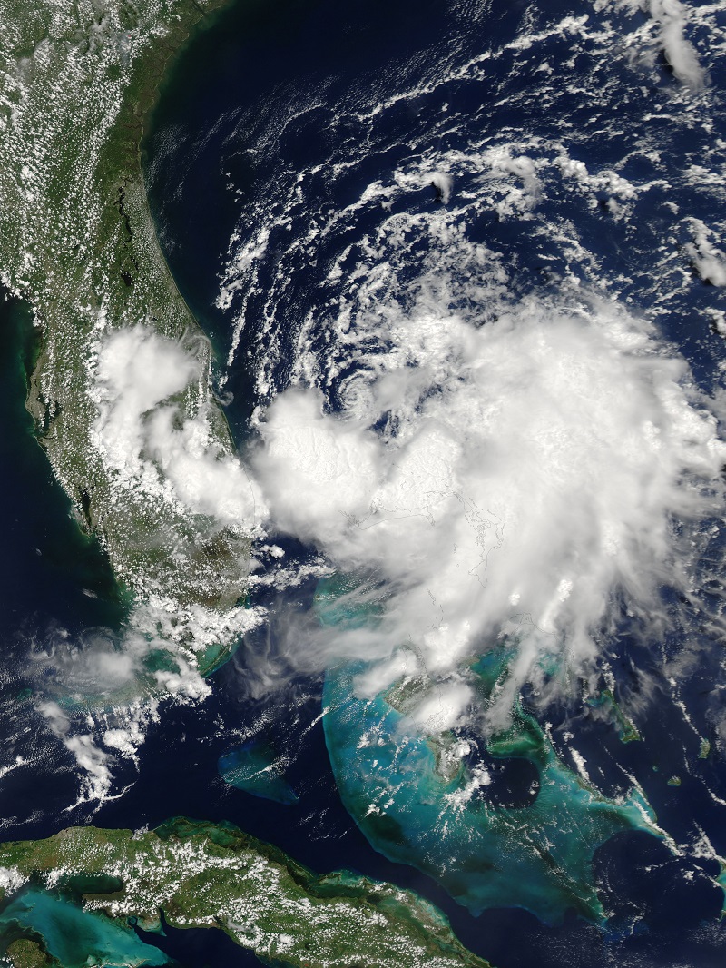
NASA’s Aqua satellite captured this image when the system was a Tropical Depression yesterday:

Read More About
Category: All, Environment, News