
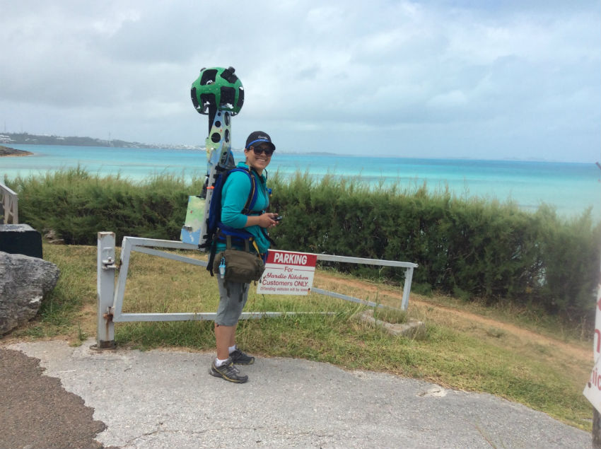
Google Maps Collects Data At Shelly Bay
In order to constantly update and add further details to its popular Maps platform, Google sends its unique vehicle-mounted cameras to streets around the world in order to obtain location photos, but one Bermuda locale required a human-mounted camera instead when the company recently paid a visit to Shelly Bay.
Photographs obtained by Google are used to populate its Street View feature, allowing users to take a close-up look at a given area when using the Maps platform.
About Street View and the photography process, Google’s website says, “To share Street View imagery with you in Google Maps, the Street View engineering team is hard at work behind the scenes.”
Official Street Views demonstration video:
“First off we need to actually drive around and photograph the locations to show in Street View. We pay close attention to many factors, including the weather and and the population density of various areas, to determine when and where can collect the best possible imagery.”

Read More About
Category: All, technology