First Stage Of Bermuda Mapping Project Complete
The Department of Land Surveys and Registration, under the Ministry of Environment, Planning and Infrastructure Strategy, commissioned an aerial survey of Bermuda, which will be conducted in two parts, with the aim of providing current geographical data of the island.
The first requires a specialist survey aircraft to take high resolution aerial photography of the island, using a camera mounted in the fuselage. This stage was completed over the weekend. Due to the changeable weather conditions over the past several days multiple flights were required to ensure cloud-free conditions. The aerial survey aircraft departed today.
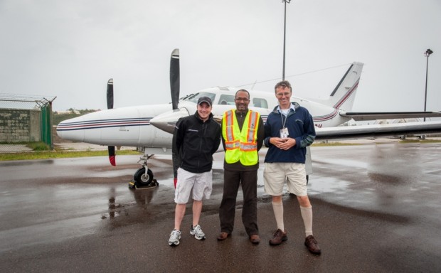
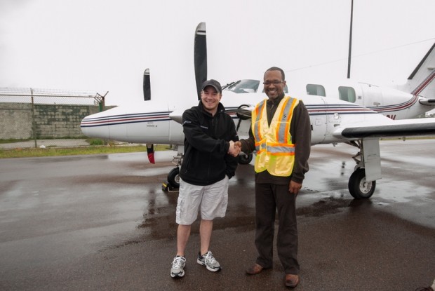
Minister Bean and Project Manager for the Bermuda Mapping Update Project in the Land Surveys Section Peter Hopkin stand on the airport runway with the aircraft in the background that was used to conduct the aerial survey:
In the second stage of the project, the survey company will extract information from the photographs, and create a digital map of Bermuda. Through this method a technician can view the ground in three dimensions, and can trace the outlines and buildings to great accuracy.
The mapping project will cost about $260,000. The data will be used extensively throughout Government, but copies of the photographs and mapping will be available for purchase by the public later in the year.
A Ministry spokesperson said, “Following the announcement in March that this survey would take place, there were questions raised on various local social media sites regarding the usage of this mapping method over Google Earth – namely, “Google Earth is available on the internet, so why are we spending public money on something that is free to anyone?”
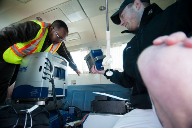
Minister Bean inspects the aircraft’s equipment in the photo below with Erik Woods:
“The key differences between this project and internet mapping solutions such as Google Earth are as follows:
- Google Earth is only available as an image, and does not include map data. The map data is actually more important to the majority of users than the background imagery because it can be used by Geographic Information System (GIS) software to calculate information. For example, if someone wanted to measure the total area of roofs in Bermuda (perhaps to measure our potential for solar energy or our water catchment) they would use the data and not the image.
- The map data will include a detailed digital terrain model, which will show the ground contours, and also a digital surface model which will show the height of every building in Bermuda. From this it will be possible to create a 3-D model of the whole country, which is certainly not possible from Google Earth.
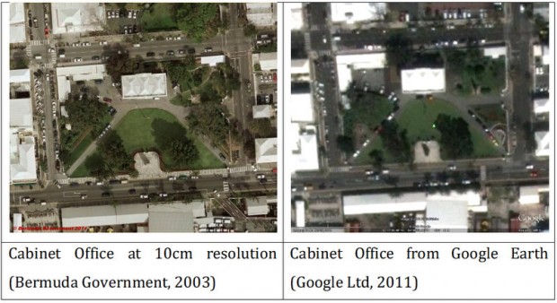
- The Google Earth imagery is also low resolution. The largest objects visible on Google Earth are a few feet across, whereas the Land Surveys Section has purchased high resolution imagery which will enable users to see objects a few inches across. For example, the Land Surveys Section are collecting the location of Bermuda’s mooring buoys with this project; the buoys are just not visible on Google.”
To compare high resolution imagery with Google Earth, below is the Cabinet Office at both 10cm resolution and from Google Earth.
Temporary Mapping Officer at the Ministry of Environment, Planning and Infrastructure Strategy Peter Hopkin said, “We have also found that the Google imagery is not quite in the right place.
“If you compare the coordinates of a point accurately positioned by our Global Position System (GPS) equipment with coordinates obtained from Google Earth, there is a difference of about 10m or 30 feet.
“This might not seem much, but if someone wants to use our data to, for example, track their vehicles, this difference will count. Some years ago we tried to contact Google to correct their imagery, without success.”
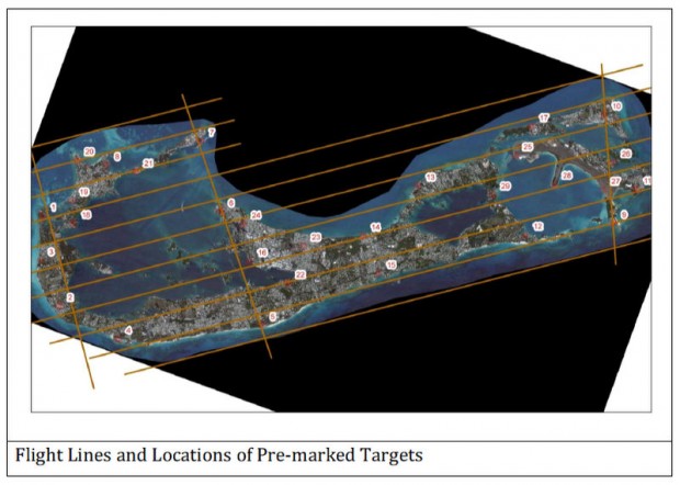
The airplane flew up and down the island at quite a low altitude, taking a series of photographs of the ground. The airplane flew a series of fifteen (15) runs in order to cover the whole island.
The aircraft’s position was constantly monitored by an inertial measurement system (which measures the aircraft’s pitch and roll) connected to a GPS which provides centremetre level accuracy every second.
The camera also contains forward motion compensation, which reduces camera-shake and blur which is created by the aircraft’s forward motion.
In the second stage of the project, the survey company will extract information from the photographs, and create a digital map of Bermuda. This process is called photogrammetry.
Erik Woods [camera operator, navigator and mechanic] pictured below with Minister Bean:
Photogrammetry is the art and science of taking measurements from imagery and uses a complex series of measurements to remove distortions in the photograph, so that accurate scaled information can be extracted.
Each image overlaps the adjacent one by 60%. Within this overlap, imagery is available from two perspectives.
“This aerial survey is the culmination of seven years’ work to upgrade Bermuda’s national reference system for modern use. There is a high, and rapidly increasing, demand for digital data for use with Geographic Information Systems (GIS) both within Government and from the private sector”, the spokesperson said.
The Minister of Environment, Planning and Infrastructure Strategy Marc Bean said, “The Bermuda Mapping Update Project is something that will be of great benefit to our island and is long overdue. Aerial photography and mapping were last updated in 2003 and since then over 1200 addresses have been created and are not mapped.”
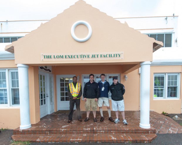
Minister Bean; pilot Mark Schubert; Peter Hopkin; Erik Woods:
Minister Bean went on to say that, “The money spent in commissioning this aerial survey is a worthy investment in bringing Bermuda’s mapping current and to the international standards.
“The finished products of this exercise are invaluable to the work of key Government agencies such as the Ministry of Public Works, the Department of Planning and the Department of Land Valuation, to mention a few.”
Members of the public with questions about the project should contact Project Manager Peter Hopkin at 294-9271.
Photos by Robert Daniels, Airport Operations
Read More About
Category: All, Environment, News


I appreciate that the this needed to be done, but you do know you have Bermudians who can do every job that was used in this project…..the photography, the flying, the digital mapping. Now before anyone comes behind me and says did these people make themselves known, the question should be did the powers that be come and advertise that they would need someones services to do this or did they just make it happen?
Albeit glad this is a step toward a modern Bermuda
Funny you mention that, Minister Bean is a qualified pilot.
I would love to know which Bermudians have a survey-grade aircraft with all of the equipment and the expertise to accurately ortho-rectify aerial photography. Please elaborate.
@FEDUP: That is just silly.
@FEDUP: That is just ridiculous.
If this project has been completed using public funds, should the information not be free of charge to taxpaying residents of Bermuda!?
It seems quite wrong that although we have already paid for this survey to be done that we must pay again to access the data!
Besides, selling these images is unlikely to raise any significant amount of revenue for the Government, whereas releasing this data to the public would provide an invaluable resource to many residents, businesses and students.
Enough of the public’s money has been taken and wasted – now that a great project has taken place, it’s time to start giving back!
no doubt
There are many residents who would no doubt find useful applications for this higher resolution and more up to date imagery.
Now they can see all the weed plantations in high resolution(note pre-marked targets)! Or are they looking for illegal developments? All jokes aside this will be useful for lots of reasons.
And the fines for illegal developments has just been increased……….But I agree, this will have its uses.
Bernews , can you determine what the significance of the ‘Pre-marked Targets’ are ?
My little neighbourhood falls square under one of the numbers and there’s nothing here that I can think of that would make it a premarked target.
It’s rural and no-where near any built up areas btw. No historic forts or buildings ,etc.
The targets are just temporary white markers on the ground that have been surveyed to known ground coordinates. The aerial surveyors can use those markers to accurately register the images to ground coordinates.
I better go and start looking to see if I can find it .. It must be within a few feet of my door !
They are mostly on Government land, but there might be some on private land with the permission of the owners.
Greetings Bermuda,
I think this form of mapping was money well spent.
What I would like to have seen was schools being able to tour the aircraft and see it’s technology. Enabling our school children such access will, more than likely inspire them to start reasearching posible areas of study and professions.
Hopefully in the future any time such actions are taken in Bermuda, there will be consideration of ecxposing our school students to these technologies!!!
Have a Safe & Blessed Day Bermuda!!!
Why are the 2003 images of better quality?
Because they were taken with a low flying aircraft rather than a satellite.
This is very useful data, especially if you are in the engineering field. Being able to look up the topography is very useful in our line of work. Every country has this available. It was money well spend.
The statement in the article that “Google Earth is only available as an image, and does not include map data…..” is simply not true. Google Maps/ Earth already provides detailed street by street mapping.
As pre-rendered map tiles, not as data objects.
Yes – but the $260K will buy Bermuda up-to-date detailed maps on a once-off basis. Do we have to pay another $260K every year to get them updated? Seems a lot more logical to use the maps which are available free and we know will be updated free intermittently. It does not take a lot of sense to see that the initial $260K is just the tip of the ice berg of charges the Bermuda people will pay for this.
It makes no sense to rely on Google’s intermittent, coarse and unreliable imagery for land administration at the scale of Bermuda. All maps and images are not the same. And all maps and images are not licenced the same. And no the Govt doesn’t have to collect it every year. The last time it was collected was in 2003, making this update highly overdue. I think you are speculating a bit wildly.
Good work to Minister Bean and his team. This is money well spent, and will benefit the country. Great step