
Two Tropical Storms Currently In Atlantic Area
Two tropical storms are currently swirling in the Atlantic, with the Bermuda Weather Service saying that Tropical Storm Laura is “not a threat to Bermuda at this time,” while Tropical Storm Marco is “not a threat to Bermuda.”
On Tropical Storm Laura, the U.S. National Hurricane Center said, “At 500 PM AST [2100 UTC], the center of Tropical Storm Laura was located near latitude 18.0 North, longitude 68.1 West.
“Laura is moving toward the west near 18 mph [30 km/h], and a generally west-northwestward motion is expected over the next few days. On the forecast track, the center of Laura will move away from Puerto Rico this evening, near or over Hispaniola tonight, near or over Cuba Sunday and Monday, and into the southeastern Gulf of Mexico Monday night and Tuesday.
Graphic courtesy of the NHC:
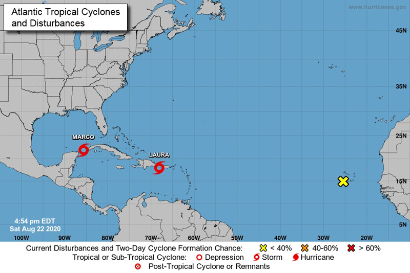
“Maximum sustained winds are near 50 mph [85 km/h] with higher gusts. No significant changes in strength are forecast during the next 48 hours while Laura moves near or over Hispaniola and Cuba. Some strengthening is forecast once Laura moves into the Gulf of Mexico Monday night and Tuesday.
“Tropical-storm-force winds extend outward up to 205 miles [335 km] from the center. A Weatherflow station at Las Mareas in Puerto Rico recently reported sustained winds of 34 mph [55 km/h] and a wind gust to 40 mph [64 km/h]. The estimated minimum central pressure is 1004 mb [29.65 inches].
On Tropical Storm Marco, the NHC said, “At 400 PM CDT [2100 UTC], the center of Tropical Storm Marco was located near latitude 21.9 North, longitude 85.7 West. Marco is moving toward the north-northwest near 13 mph [20 km/h]. Marco is expected to continue moving toward the north-northwest across the central Gulf of Mexico on Sunday and is forecast to reach the northern Gulf coast on Monday. After moving inland, Marco is expected to slow down and turn toward the northwest and west-northwest Monday night and Tuesday, moving across southern Louisiana into east Texas.
“Maximum sustained winds are near 65 mph [100 km/h] with higher gusts. Strengthening is forecast during the next day or two, and Marco is expected to become a hurricane tonight or on Sunday. Marco is likely to still be at or near hurricane strength when it reaches the northern Gulf coast on Monday. Weakening is forecast to occur while the center moves farther inland Monday night and Tuesday.
“Tropical-storm-force winds extend outward up to 90 miles [150 km] from the center. The estimated minimum central pressure is 992 mb [29.30 inches].”
