Tammy Transitions Into A Post-Tropical Cyclone
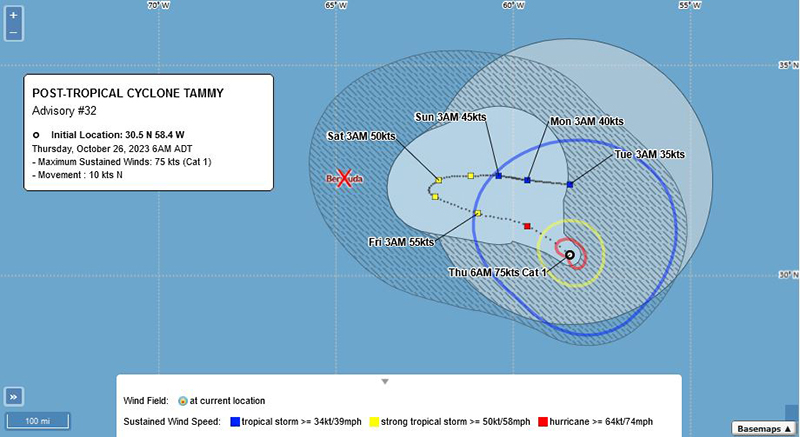
Strong to gale force winds are forecast develop today [Oct 26] as Tammy — which is now classified as a post-tropical cyclone – passes to our east.
The latest BWS forecast said, “Strong to gale force winds develop today as Tammy, now merging with a front and becoming post-tropical, makes a close approach to our east.
“Further blustery showers are expected, mostly during Friday. The weekend then sees winds easing and more settled weather developing as post-tropical Tammy clears away east. Hazardous surf and rip currents are now present as easterly swells continue to build.
Graphic courtesy of the BWS:
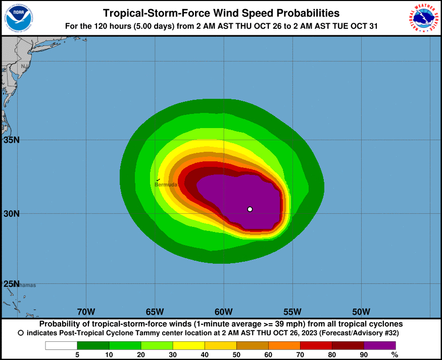
The latest forecast from the U.S. National Hurricane Center said, “At 500 AM AST [0900 UTC], the center of Post-Tropical Cyclone Tammy was located near latitude 30.5 North, longitude 58.4 West. The post-tropical cyclone is moving toward the north near 12 mph [19 km/h]. The system should begin to move northwestward later this morning, followed by a slower west-northwestward motion on Friday.
Graphic courtesy of the NHC:
“Maximum sustained winds have decreased to near 85 mph [140 km/h] with higher gusts. Some weakening is expected during the next few days.
“Hurricane-force winds extend outward up to 30 miles [45 km] from the center and tropical-storm-force winds extend outward up to 195 miles [315 km].
“The estimated minimum central pressure is 973 mb [28.74 inches].”
Read More About
Category: All


