
BWS: Arthur Downgraded To ‘Post-Tropical’
The first named Atlantic storm of the year has been downgraded, with the now Post-Tropical Cyclone Arthur to bring “warm, moist, and unstable air” over Bermuda, according to the Bermuda Weather Service [BWS].
The latest forecast from the BWS says, “Warm, moist and unstable air will continue to be drawn over Bermuda as Post-Tropical Cyclone Arthur hovers to our north-northwest. Its remnants are forecast to cross directly overhead later this evening and bring another round of showery and breezy weather.
“Arthur will then dissipate and exit to our southeast on Thursday, providing the island with stable atmospheric conditions and much more pleasant humidity levels.”
Graphic courtesy of the NHC:
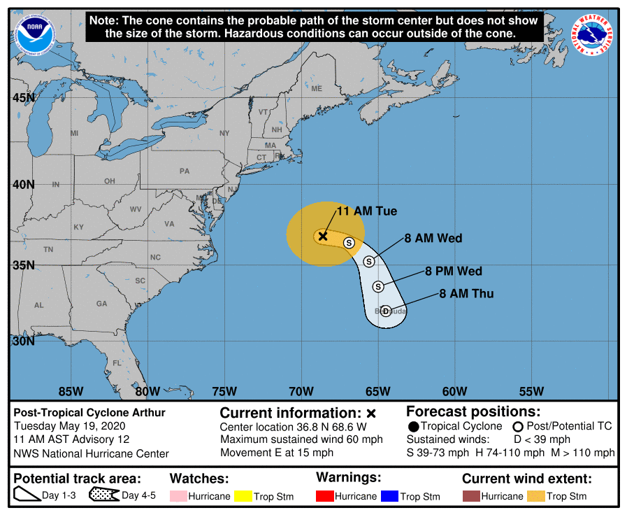
The latest forecast from the U.S. National Hurricane Center said, “Arthur has transitioned into an extratropical low this morning with a warm front extending northeastward from the circulation, any deep convection only along the front, and lots of more stable cumulus clouds near the center. Thus this is the last advisory.
“The initial intensity remains 50 kt based on continuity and model analyses.
“The main adjustments to the previous forecast include a quicker dissipation of the post-tropical cyclone, somewhat linked to the models showing a faster weakening after 12 hours, and a continuation of the westward shift in the track forecast in a day or two. These changes are consistent with the latest model consensus for track and similar to a GFS/ECMWF blend for intensity.
“Dangerous coastal surf conditions and rip currents are expected to continue along portions of the mid-Atlantic and southeast U.S. coasts during the next couple of days.”
