
NOAA Map Shows Storms Over A Century
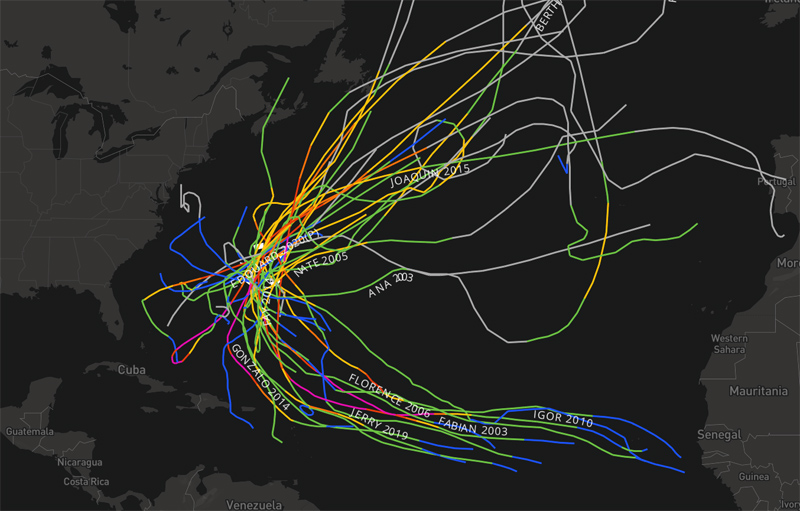
A map from NOAA shows all tropical storms and hurricanes that were a threat to Bermuda — as in passing within 100 nautical miles – this century.
The Bermuda Weather Service [BWS] posted the map below online, saying, “This map from NOAA shows all tropical storms and hurricanes that were a threat to Bermuda [passing within 100nm] this century.
“This year, we have updated our procedures so that we only issue Bermuda-centric Tropical Update Bulletins when a tropical system in question is within a defined area that represents historical landfall risk for Bermuda. That way, you will no longer see bulletins from BWS on storms that are not expected to have any impact to the island.
“The Bermuda Weather Service’s role is to observe, forecast and warn on the local weather conditions. The US National Hurricane Center [NHC] is charged to make predictions of the characteristics and track of each tropical system in the region. If you have interest in seeing information on storms that are not forecast to come anywhere in our vicinity [for example in the Gulf of Mexico, or deep in the Caribbean Sea], there is a wealth of information on the NHC website, which we have also linked more prominently to our own website’s tropical pages.”

Read More About
Category: All